Maps and Politics
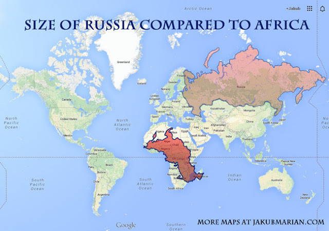
Every map uses some kind of projection to print something spherical in this case our world on a plane two dimensional surface ie. paper.
In a Mercator projection which is the norm in most atlases the countries that lie in the northern latitudes are shown to be disproportionately larger than the ones near the equator. Check out the massively exaggerated size of Greenland and Russia due to the errors of Mercator projection, chosen deliberately to emphasize Northern Hemisphere.


In contrast this projection below is an equal area Gall Peters projection.


Comments
Post a Comment